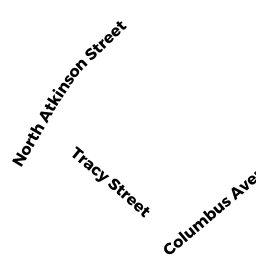
2 TRACY ST
Owner Information
GURNEY JOSHUA P
2 TRACY ST
NEWBURYPORT, MA 01950


Property Details
2 TRACY ST is classified as a Single Family Residential (Cape cod).
The primary structure on this property was built in 1949. There are 2304ft2 of built area within this property. There is 1037ft2 of residential/living space within this property. This property is listed as having 50 rooms.
2 TRACY ST is valued at 387000. The land is valued at 262900 and the structures are valued at 124100.
This property is in Zone R2. Confirm with local Zoning Board authorities to ensure there are no overlays or other easements on this property.
The most recent deed for 2 TRACY ST is recorded at the local registrar in Book 32413, Page 127. 2 TRACY ST was last sold on 2013-04-25 for 250000.
Assessment data from fiscal year 2021.
Flood Data
According to the FEMA National Flood Hazard Layer, this property does not appear to be in a flood zone. It may also be in an area not yet reviewed. Nonetheless, confirm this information prior to taking any action.
To view the flood hazards around this property, create a FEMA "Firmette" Map of the area around 2 TRACY ST.
Broadband Internet Providers
| Provider | Type | Bandwidth (mbps) | |
|---|---|---|---|
| Viasat Inc | Satellite | 100 | 3 |
| VSAT Systems, LLC. | Satellite | 2 | 1 |
| HughesNet | Satellite | 25 | 3 |
| GCI Communication Corp. | Satellite | 0 | 0 |
| T-Mobile | Fixed Wireless | 25 | 3 |
| Comcast | Cable | 1000 | 35 |
| Verizon New England Inc. | DSL | 15 | 1 |
Broadband service provider data from December 2020.
Adjacent Properties
- 10 COLUMBUS AVE
Single Family Residential owned by KIRKPATRICK SCOTT D - 4 TRACY ST
Single Family Residential owned by CHISHOLM JOHN B - 18 COLUMBUS AVE
Single Family Residential owned by WILLIAMSON JEFFREY J - 20 COLUMBUS AVE
Single Family Residential owned by ZIMMERMAN ANN MARIE - 22 COLUMBUS AVE
Single Family Residential owned by SANBORN NATASHA HAY